


Your Guide to Spring Backpacking in Oregon
Memorial Day weekend marks the unofficial start of backpacking season in Oregon. While many of the state's high-alpine trails remain buried under snow until mid-summer, there are still plenty of snow-free backpacking routes to explore—especially in central and southern Oregon.
If you're looking for an early-season backpacking trip, the key is to stay below 5,000 feet in elevation, as most areas above this threshold will still have lingering snow. Eastern and southern Oregon tend to melt out faster, making them great options for May backpacking trips.
The following Memorial Day backpacking trips are tried-and-true routes that offer stunning scenery, manageable trail conditions, and ideal spring weather.


Rogue River Trail: A Classic Spring Backpacking Route
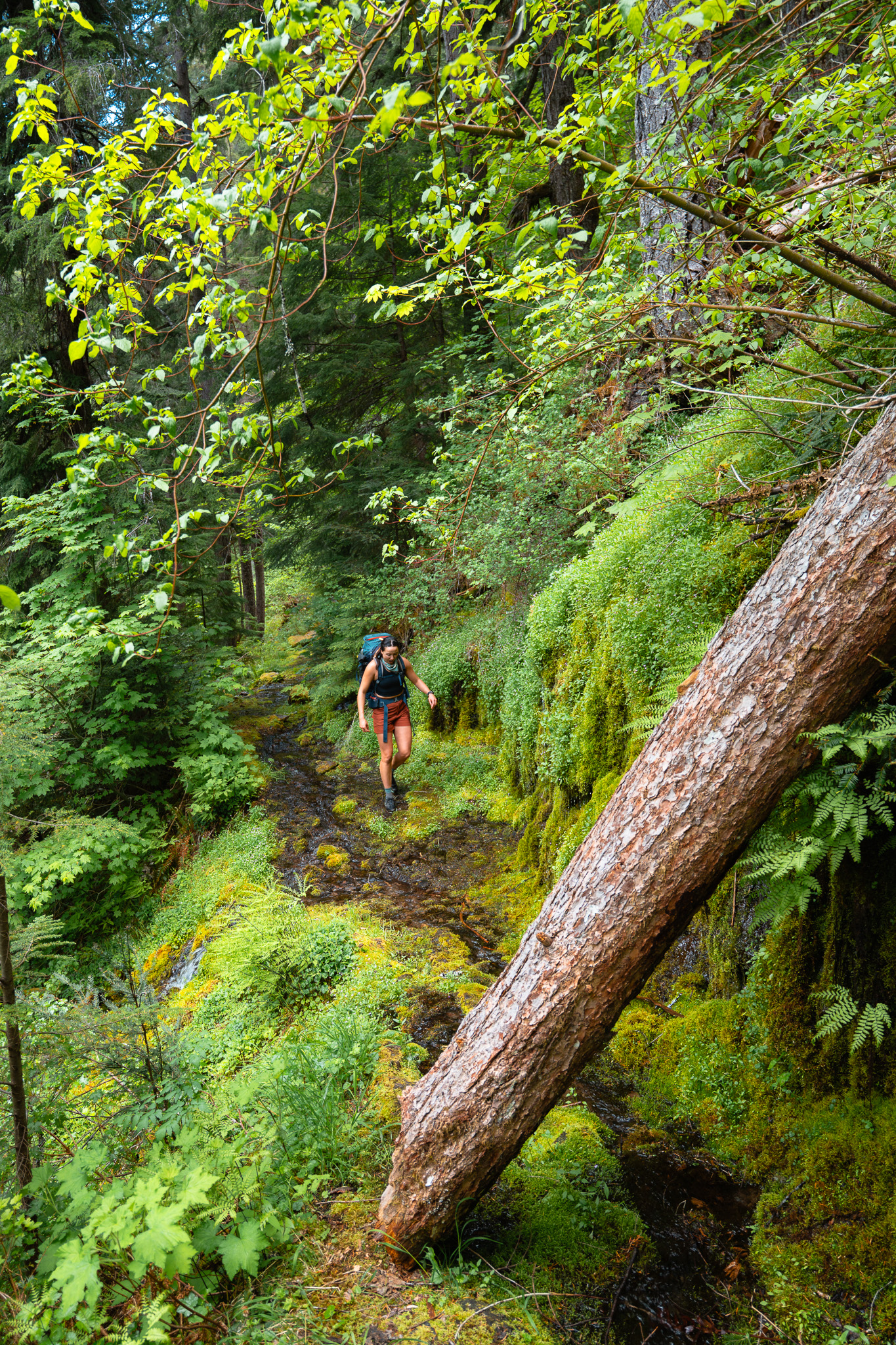
The 40.5-mile Rogue River National Scenic Trail follows the Rogue River from Graves Creek toward the Pacific Ocean, offering spectacular canyon views, lush forests, and historical landmarks. Located about four hours from Portland, this trail is a perfect early-season backpacking trip, as the lower Rogue Valley gets extremely hot in the summer but remains comfortable in the spring.
Trail Overview
| LENGTH | ELEVATION | DIFFICULTY | PERMITS | TRAILHEAD |
|---|---|---|---|---|
| 40.5 miles one way | Moderate, with gradual descent from Graves Creek | Moderate-Difficult | Northwest Forest Parking Pass | Graves Creek Boat Ramp |
Best For: Multi-day point-to-point or out-and-back hikes

Why This Trail is Great for Memorial Day
- Lower elevation = No snow
- Less crowded than summer months
- Mild temperatures compared to peak summer heat
- Wildlife sightings (black bears, deer, bald eagles)
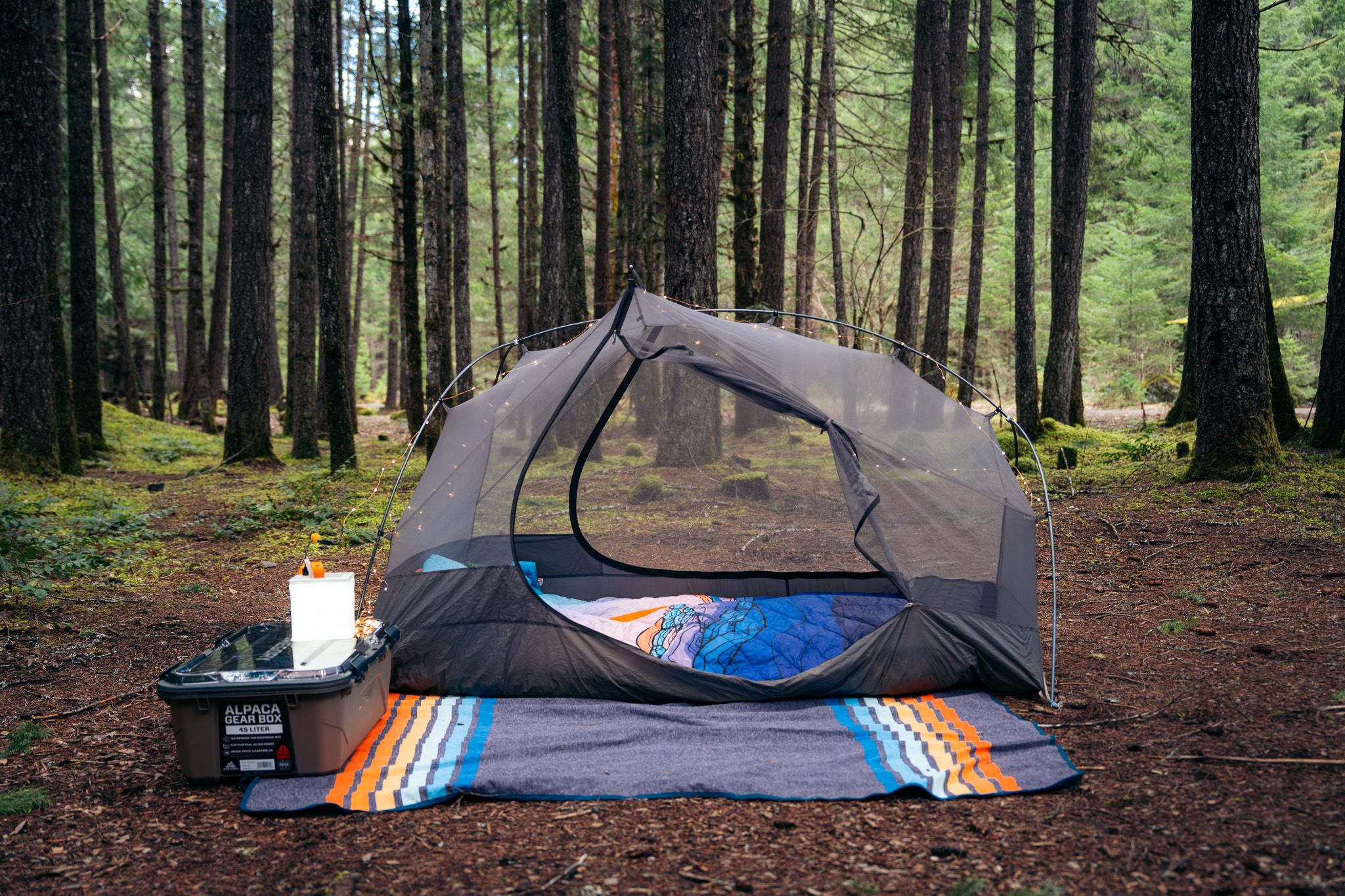
Logistics & Camping
A popular way to hike this trail is to set up a shuttle from Graves Creek and hike point-to-point to the Rogue River Ranch or beyond. When I last hiked this in 2019, I did a 54-mile out-and-back with two nights at Meadow Creek, making it a 13.5-mile hike in, a 27-mile day hike past Marial, and a return hike out.
The Bureau of Land Management (BLM) has a detailed guide on mileage, camping options, and water sources. This is a bear country trail, so plan to use a bear canister or hang your food.
Trail Hazards & Things to Know
- Ticks are common—check yourself daily.
- Black bears frequent the area—store food properly.
- Landslides—always check conditions.
- River crossings can be tricky in spring—always check conditions.


McKenzie River Trail: Waterfalls, Lava Fields, & Hot Springs
The 27-mile McKenzie River Trail is one of Oregon’s most scenic backpacking routes, featuring waterfalls, crystal-clear pools, lava flows, and hot springs. This is an excellent Memorial Day weekend hike, as the trail is typically snow-free by late May and offers a mix of forests, river views, and iconic landmarks like Tamolitch Blue Pool.
Trail Overview
| LENGTH | ELEVATION | DIFFICULTY | PERMITS | TRAILHEAD |
|---|---|---|---|---|
| 27 miles one way | 4,458 feet | Moderate | Northwest Forest Parking Pass | Clear Lake |
Best For: Point-to-point hike or out-and-back sections
Highlights Along the Trail
- Clear Lake: A strikingly clear spring-fed lake with underwater ancient trees.
- Sahalie & Koosah Falls: Two of Oregon’s most stunning waterfalls.

- Tamolitch Blue Pool: A breathtaking deep blue pool formed by an underground river.

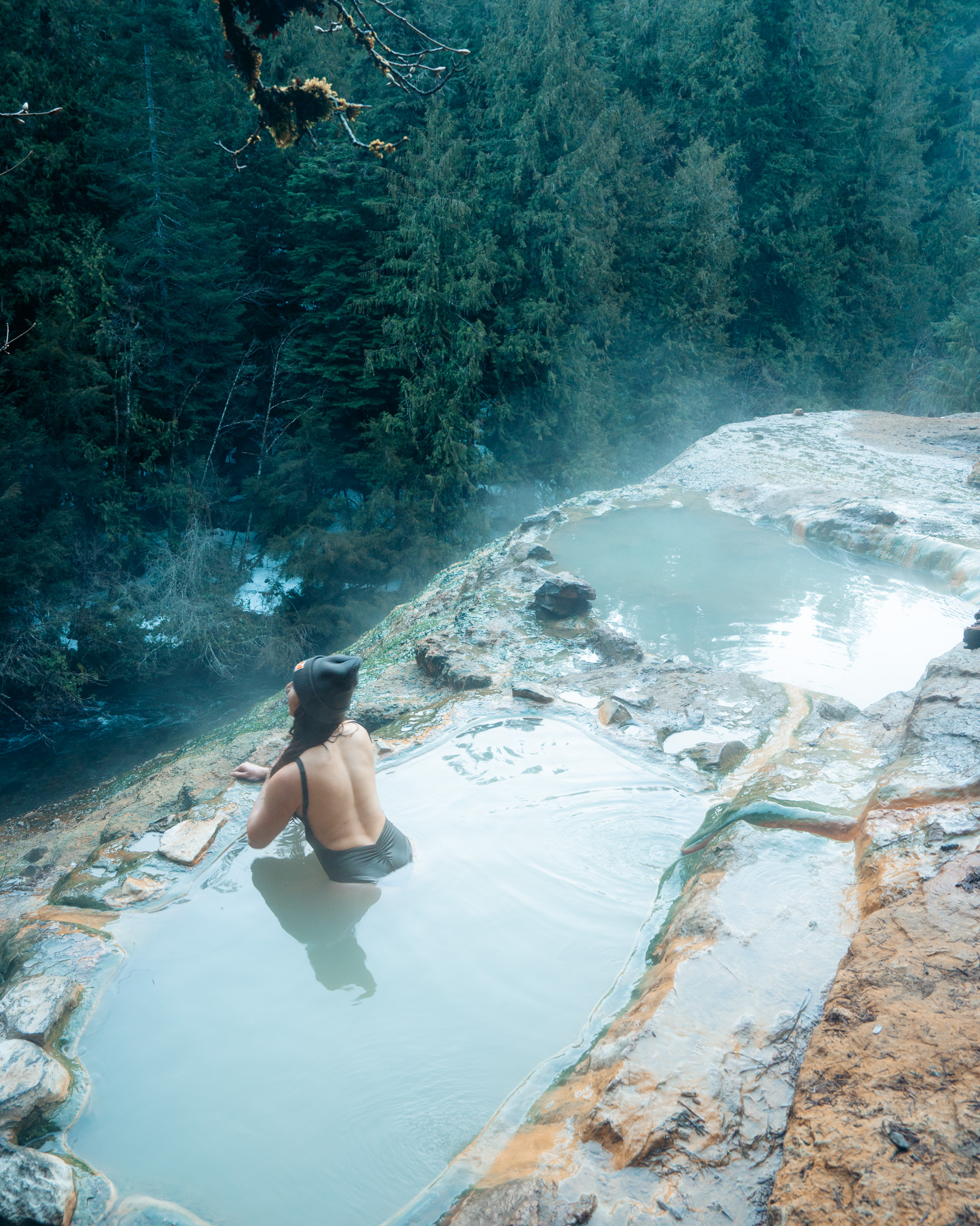
- Bigelow (Deer Creek) Hot Springs: A primitive riverside hot spring for soaking.

Trail Conditions & Hazards
- Spring snow is rare but possible near Clear Lake
- Mosquitoes can be bad near still water
- Blue Pool & Bigelow Hot Springs areas are very crowded on weekends
Best Camping Areas on the McKenzie River Trail
Finding camping spots along the McKenzie River Trail can be challenging due to limited designated sites and dispersed camping restrictions. However, with some planning, you can secure a great campsite for your Memorial Day backpacking trip. Here are the best designated campgrounds and potential dispersed camping options along the trail:
1. Coldwater Cove Campground (Near Clear Lake – Mile 0-2)
- Pros:
✔ Designated sites with picnic tables, fire pits, and vault toilets
✔ Stunning lake views and access to Clear Lake
✔ Great for an easy first-night stop - Cons:
❌ Requires reservations & a camping fee
❌ No dispersed camping allowed near Clear Lake - Best for: Backpackers starting late or looking for a more developed first-night campsite.
2. Trail Bridge Campground (Mile 15-16) – Best Midpoint Optio
- Pros:
✔ Closest established campground to the middle of the trail
✔ Located near Trail Bridge Reservoir with easy water access
✔ Vault toilets and picnic tables - Cons:
❌ Campground fills up quickly—arrive early or reserve in advance
❌ No showers or potable water (must filter from the river) - Best for: A solid mid-trail campsite for those backpacking the full trail.
3. Deer Creek Road Dispersed Camping (Near Blue Pool – Mile 9-10)
- Pros:
✔ Some backpackers have found informal dispersed camping spots nearby
✔ Close to Tamolitch Blue Pool and the McKenzie River Trail - Cons:
❌ Camping is NOT allowed directly at Blue Pool
❌ Limited & not guaranteed—depends on availability - Best for: Experienced backpackers who can find a backcountry spot away from day-use areas.
Note: If dispersed camping isn’t available, Trail Bridge Campground is the next best option.
4. Olallie Campground (Mile 25-26) – Near the End of the Trail
- Pros:
✔ Well-shaded sites with picnic tables and fire rings
✔ Right along the McKenzie River, offering scenic views
✔ Vault toilets & potable water available - Cons:
❌ Can be crowded on weekends, so reserve in advance
❌ Located closer to McKenzie Bridge rather than mid-trail - Best for: Final-night camping before heading home or a comfortable camping option near McKenzie Bridge.
5. Belknap Hot Springs (Private Campground & Lodge – Mile 26.5)
- Pros:
✔ Access to developed hot springs—a great post-hike soak
✔ Tent sites, RV sites, and lodge accommodations available
✔ Showers, general store, and amenities - Cons:
❌ Requires reservations & a fee
❌ Not a true wilderness experience - Best for: Hikers looking for a more comfortable or luxury end-of-trip stay.
")


Upper Rogue River Trail: A Remote and Scenic Waterway Hike
The Upper Rogue River Trail follows the Rogue River from North Fork Dam to Union Creek, winding past lava tubes, waterfalls, and undeveloped campsites. In 2020, I hiked a 47-mile out-and-back route, camping along the river and exploring the trail’s unique geology.
Trail Overview
| LENGTH | ELEVATION | DIFFICULTY | PERMITS | TRAILHEAD |
|---|---|---|---|---|
| 47 miles one way | Moderate, with rolling hills | Difficult | Northwest Forest Parking Pass | North Fork Dam |
Best For: Experienced backpackers looking for a remote, off-the-beaten-path adventure
Trail Highlights
- Natural Bridge: A lava tube where the river disappears underground.
- Rogue River Rapids: Plenty of opportunities for fishing and swimming.

- Morel & King Bolete Mushrooms: Found in late spring near the lower sections of the trail.

- Lower elevation = snow-free earlier than many mountain trails
- Less crowded than Oregon’s more popular trails
- Interesting geological features like lava tubes & waterfalls
Unexpected Trail Challenges: Why We Had to Turn Back
During our 2020 backpacking trip, we had to turn back earlier than expected due to extensive tree fall and overgrown sections of the trail. Right after passing Farewell Bend Campground, we encountered multiple downed trees, dense overgrowth, and impassable sections that made further travel too difficult.
Additionally, many of the trail signs use common names, making it easy to take a wrong turn. We accidentally followed an incorrect path and had to backtrack, adding unexpected mileage and time to our trip. Double-check your map and GPS to ensure you're staying on the correct route!
If you're planning this trip, be prepared for rough conditions and always check recent trail reports from the U.S. Forest Service. Spring storms and seasonal overgrowth can make this trail harder to navigate than expected.
Final Thoughts: Is the Upper Rogue River Trail Worth It?
Yes—but only if you’re prepared for unpredictable conditions. If you’re looking for a rugged, lightly trafficked route with stunning river views, this trail is a great spring backpacking option. Just be flexible with your plans


North Umpqua Trail
The North Umpqua Trail is a 79-mile trail system that follows the North Umpqua River through lush old-growth forests, cascading waterfalls, and remote hot springs. This lesser-known gem is perfect for an early-season backpacking trip in Oregon, as its lower elevation means sections of the trail melt out by late spring, making it a great Memorial Day weekend adventure.
Trail Overview
| LENGTH | ELEVATION | DIFFICULTY | PERMITS | TRAILHEAD |
|---|---|---|---|---|
| 79 miles one way | Moderate, with rolling hills | Difficult | Northwest Forest Parking Pass | Multiple access points, including Swiftwater, Mott Bridge, and Marsters Trailheads |
Best For: Point-to-point or section hikes with river views and waterfalls
Why the North Umpqua Trail is Great for Memorial Day
✔ Snow-free sections available in late spring
✔ Waterfall-filled route with stunning river views
✔ Less crowded than many Oregon trails
✔ Great for shorter section hikes or a full thru-hike
Planning Your Trip: Choosing a Section
The North Umpqua Trail is divided into 11 sections, each offering different scenery and difficulty levels. For a Memorial Day weekend trip, we recommend choosing a 20-30 mile section to explore over 2-3 days.
Best Section: The Dread and Terror Segment (Miles 28-43)
✔ The most scenic section of the North Umpqua Trail
✔ Incredible waterfalls, moss-covered forests, and lush river views
✔ Follows the North Umpqua River through rugged, dramatic terrain
✔ Best option for a rewarding and picturesque backpacking trip

The Dread and Terror segment is named by Civilian Conservation Corps (CCC) firefighters who worked in the area in the 1930s. They found this section particularly grueling due to the rugged terrain, steep slopes, and dense vegetation, making wildfire suppression incredibly difficult.
Don’t let the name fool you—this section is absolutely breathtaking. Expect lush old-growth forests, endless river views, and multiple waterfalls along the way.

Trail Highlights
- Toketee Falls – A stunning two-tiered waterfall dropping into a deep basalt amphitheater. One of Oregon’s most photographed falls.


- Lemolo Falls – A 165-foot powerful cascade, one of the tallest waterfalls in the area. Accessible via a short side trail from the main route.
- Susan Creek Falls – A picturesque 50-foot waterfall surrounded by lush greenery, with a short detour from the trail.
- Lemolo Lake – A beautiful alpine lake with dispersed camping, great for a lakeside overnight stop. Offers fishing, kayaking, and stunning views of Mt. Thielsen.
- North Umpqua River Views – The trail follows the river for miles, offering vibrant blue pools, lush old-growth forests, and scenic rapids.

- Fewer Crowds – A less-traveled alternative to Oregon’s busier backpacking routes, offering solitude and peace.
Important Trail Conditions: Flooded Sections on the North Umpqua Trail
Be prepared for high water crossings! The North Umpqua Trail can be prone to flooding in spring, especially in sections that run close to the river. When I hiked this trail in 2023, I encountered a waist-high water crossing in one section, making for a challenging and unexpected obstacle.
Before heading out, check recent trail reports or contact the BLM or U.S. Forest Service for updates on water levels.
Planning Your Memorial Day Backpacking Trip
What to Pack for Early-Season Backpacking
- Waterproof Boots (trails may still be wet)
- Layered clothing (spring weather can shift quickly)
- Bear canister or Ursack (especially fhttp://Bugor Rogue River trips)
- Bug spray & tick repellent (essential for spring hikes)
Early-Season Trail Conditions to Check
- Current snow levels (look at trail reports before heading out)
- River crossings (some trails may have high water in spring)
- Fire restrictions (even in spring, fire bans may be in place)
Final Thoughts: Kick Off Backpacking Season This Memorial Day
Memorial Day weekend is the perfect opportunity to start backpacking season in Oregon, and these early-season trails offer the best balance of accessibility and adventure. Whether you’re hiking along the Rogue River, exploring waterfalls on the McKenzie, or tackling the Upper Rogue Trail, you’ll find scenic landscapes through lush, old forests, fewer crowds, and ideal spring conditions.
Planning your trip? Let me know where you're headed this Memorial Day in the comments!
More Camping & Backpacking Guides:
- Best Backpacking Meals & Recipes
- Umpqua Hot Springs in Oregon: Your Guide to Hike, Soak, and Camp
- Top 4 PNW Backpacking Trips Of 2023
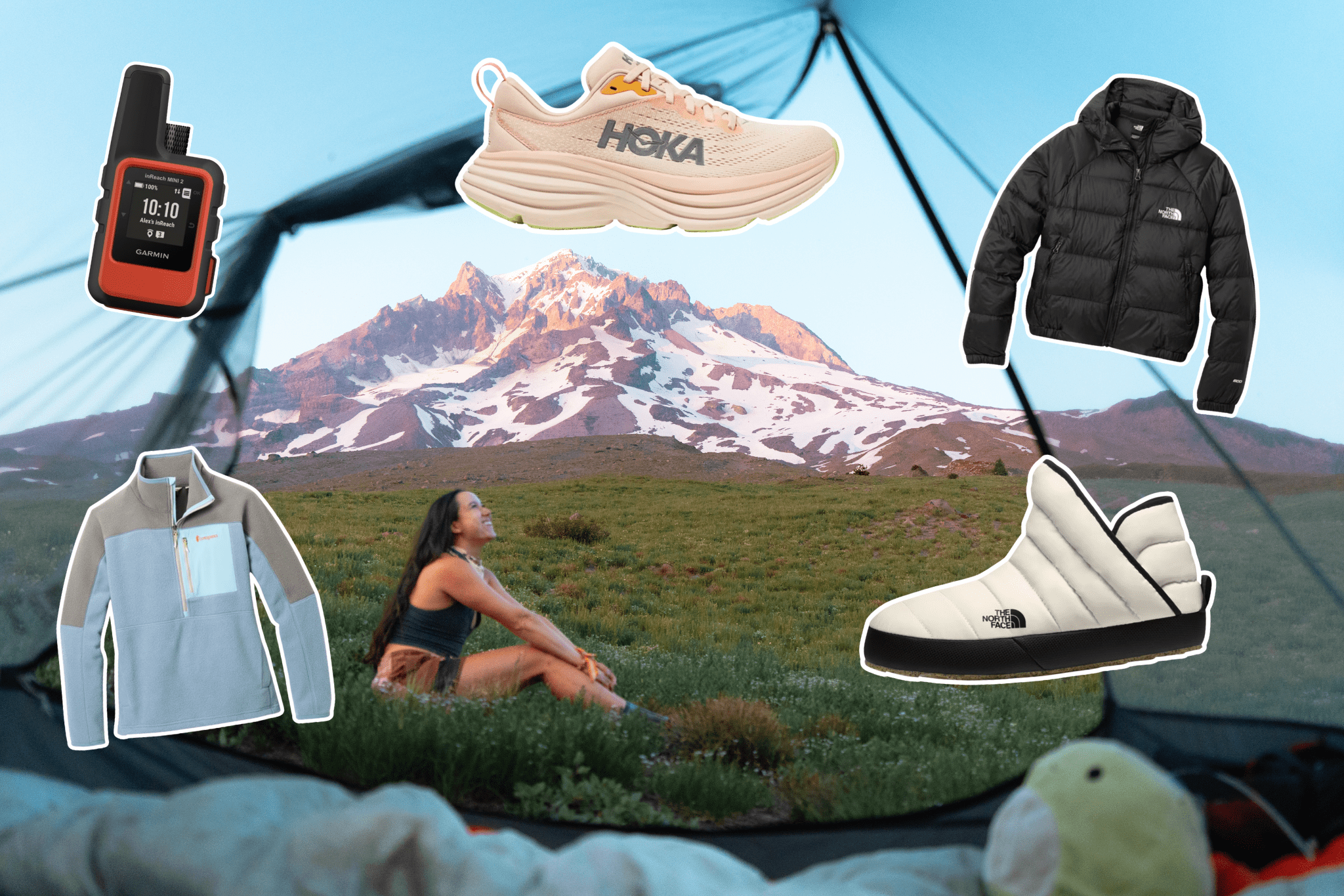
What To Pack
Backpacks

- Women's Lightweight Beginner Backpack (55L)
- Women's Backpack (code LAUREN15 to save 15%)
- Men's Lightweight Beginner Backpack (55L)
- Men's Ultralight Backpack (58L, code LAUREN15 to save 15%)
Sleep System

Tents
- Beginner Backpacking Tent (2-person+)
- Lightweight Tent (2-person)
- Ultralight Tent (2-person)
Sleeping Bags
- Beginner Sleeping Bag (25° F, narrow)
- Beginner Sleeping Bag (30° F, less constricting)
- Lightweight, Packable Sleeping Bag (30° F, less constricting)
- Sleeping Bag Liner
Sleeping Pads
- Beginner Sleeping Pad (R-Value 4)
- Women's Lightweight Sleeping Pad (R-Value 3.5)
- Men's Lightweight Sleeping Pad (R-Value 3.2)
- Ultralight Sleeping Pad (Foam, R-Value 2)
Sleeping Pillows
Camping Kitchen

Cooking
Utensils
Water
Food Safety
Snacks & Meals

Electrolytes
Breakfasts
Dinners
Snacks
- Honey Stinger Waffle
- Pro Meal Bar (I LOVE banana bread)
- Dried Mangos
- Peanut Butter Chocolate Chip Cookie Bites
Toiletries

- Toiletry Baggy (Medium)
- Tooth Brush
- Tooth Paste Tabs
- Face + Body Wipes
- Dehydrated Wipes
- Anti-Chafe
- Clean Anti-Chafe (code LAUREN15 to save 15%)
- Natural Anti-Chafe
- Face + Body Lotion
- After Bug Bites
- Clean Relief Balm (code LAUREN15 save 15%)
- Clean SPF (waterproof, code LAUREN15 to save 15%)
Safety
Entertainment + Extras

Support the Blog & Stay Connected!
If you found this guide helpful, here’s how you can support me:
- Like this post & share with a hiking friend
- Subscribe to my newsletter for trip reports & tips
- Shop through my REI link for your gear needs
See you on the trail!
Happiest Outside,
Lauren (@laurensbigadventure)


Read the Comments +